+12 more
$2,800,000
Listed by: Sutton Group-West Coast Realty · MLS®
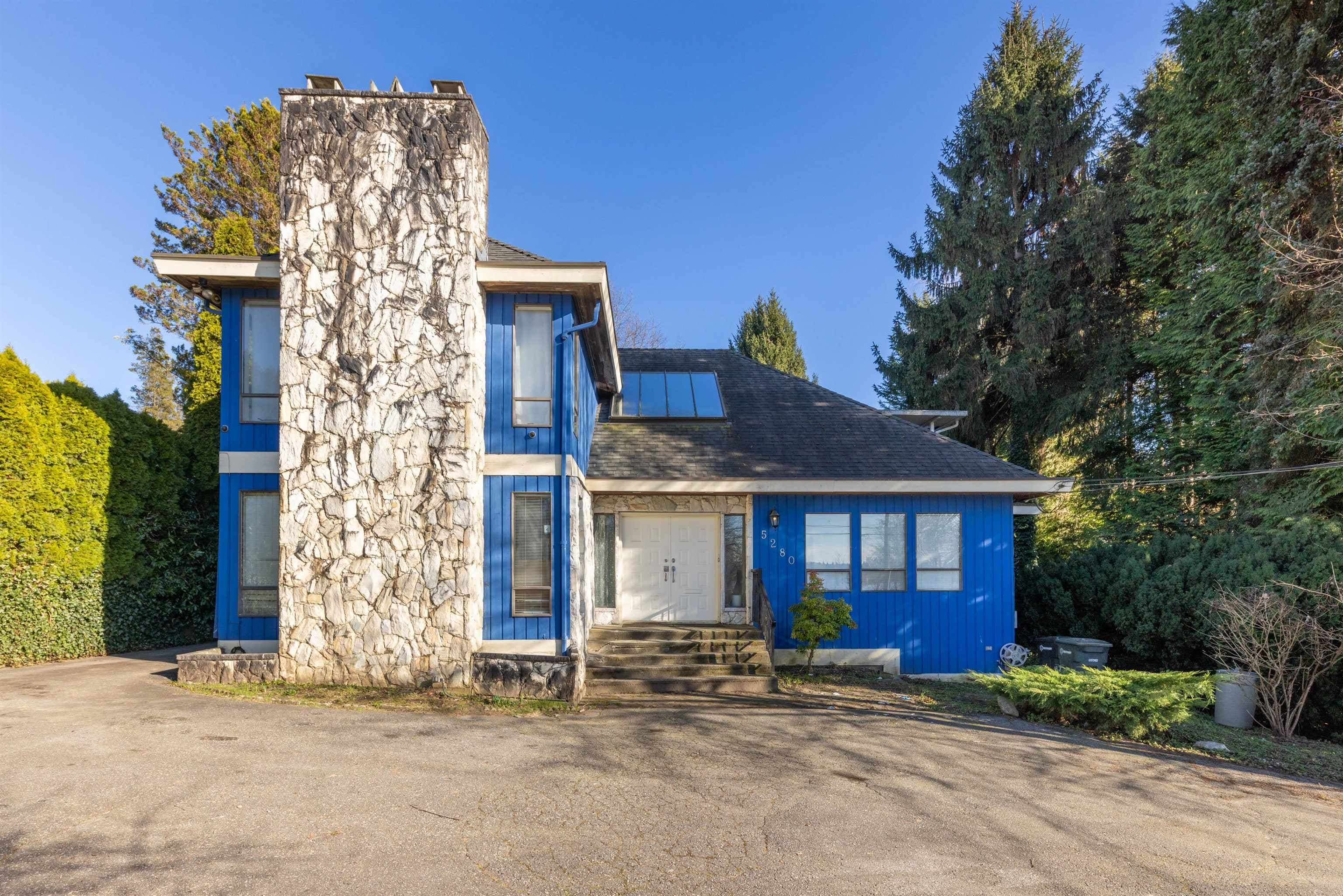
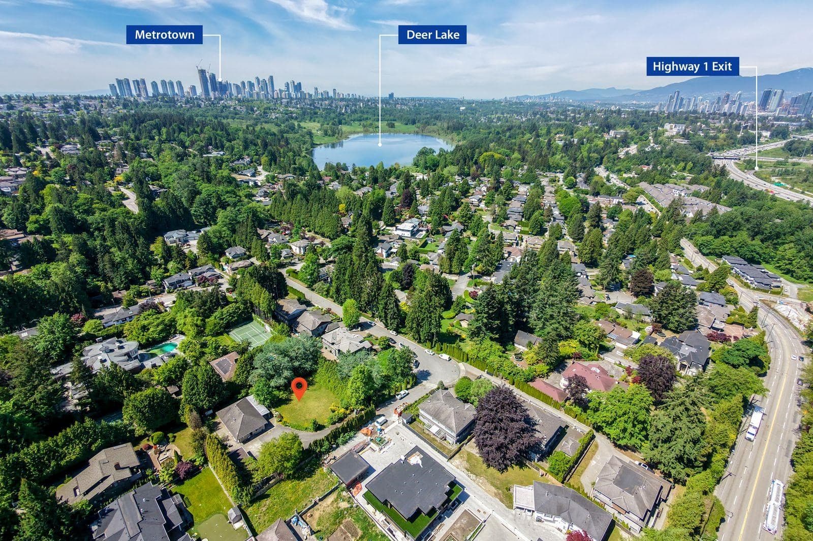
Extremely RARE offering of a HUGE 80' frontage x 244' Deer Lake property! 19,520 total square footage, situated down and away from Burris Street with 244 feet in lot depth! 6 units are permitted to be built under the Burnaby's new SSMUH zoning bylaw. Because this lot is 19,520 SF, this new zoning bylaw allows for massive square footage to build 6 large units! The extra wide 80' frontage provides ample clearance to put a road along the side to access the back units. Lots of room for a double garage and backyard space for all 6 units compared to the other smaller lots that do not have the space and the wide access to the street! 13 minute walk to Deer Lake Parklands with all its walking trails around the lake! Short drive to Metrotown or Highgate. Easy access to Highway 1 and Kingsway.
MLS® #
R3156294
Status
Active
Type
Residential
Sub-type
Single Family Residence
Style
Rancher/Bungalow w/Bsmt.
Ownership
Freehold NonStrata
Bedrooms
4
Full Baths
2
Half Baths
1
Fireplaces
2
Living Area
3,033 sqft
Main Floor
1,728 sqft
Basement
Yes
Lot Size
19,520 sqft
Lot Dimensions
70 x 244
Frontage
70
Year Built
1958
Age
68 years
Structure
Residential Detached
Parking Stalls
4
Parking Type
Open, Front Access
Taxes
$8,886.9/yr
MLS® Area
Deer Lake
City
Burnaby
Postal Code
V5E 1Z1
Subdivision
Deer Lake
Heating
Forced Air · Natural Gas
Laundry
In Unit
Fireplace
Wood Burning
Interior Features
Storage
Exterior Features
Garden · Balcony
Lot Features
Central Location, Recreation Nearby
Pool
Outdoor Pool
Community
Shopping Nearby
Coordinates: 49.233729, -122.958272 · Map data © Google
Watch this home
Get an email when the price changes, it sells, or it goes off the market. Sign in or create a free account.
Multiplex potential: on a ~1,813 m² lot, BC’s small-scale housing law requires the municipality to allow at least 4 units (up to 6 near frequent transit), where it applies.
Screening estimate from provincial regulations (TOA station points, B.C. Reg. 263/2023 & 265/2023; small-scale multi-unit housing rules). Distances are straight-line; actual TOA maps are set by municipal bylaw and some parcels (heritage, ALR, exempt areas) are excluded. Confirm with the municipality before relying on it.
Not in the Agricultural Land Reserve.
The listing’s flood plain disclosure is available to registered users. Create a free account
ALR from the Agricultural Land Commission via DataBC (point check at the listing’s mapped location). Flood plain is the listing brokerage’s disclosure. Confirm both with the municipality and your lawyer.
Building permit history is currently available for City of Vancouver properties only.